


Last updated: 06/16/2021
Discover the Big Sur region, one of the most scenic stretches of scenic Highway 1, the beautiful highway in California with incredible views of the Pacific Ocean. Here you'll find information about stops, state parks, where to eat, where to stay and much more!
THE BIG SUR REGION
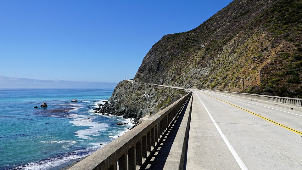
Big Sur is probably the most stunning stretch of coastline in California and considered one of the most beautiful in the world! Traveling along Highway 1, the road that borders the Pacific Ocean, it is possible to discover this beautiful region, full of stunning natural beauty and seaside cliffs. The region was one of the most inaccessible areas in California and the entire United States until, after 18 years of construction, the Carmel-San Simeon Highway (now known as part of Highway 1) was completed in 1937. After visiting the cities in half moon bay, Holy Cross, Monterey and carmel, it's time to go on a journey stretch of about 115 km that extends to the city of San Simeon. The drive along the narrow, winding road rewards visitors with gorgeous vistas, coastal redwood forests, beaches, state parks, outdoor sports areas, and more. The region encompasses a number of small communities that include: Big Sur, Lucia, Gorda and San Simeon.
About 60% of the coastal region is owned by government or private agencies that do not allow any development. These include state parks and reserves (Garrapata State Park, Point Sur State Historic Park, Andrew Molera State Park, Pfeiffer Big Sur State Park, Julia Pfeiffer Burns State Park, John Little State Natural Reserve, Limekiln State Park and Hearst San Simeon State Park), in addition to marine conservation areas Big Creek State Marine Reserve and Marine Conservation Area.

ORIGIN OF THE NAME “BIG SUR”
The name “Big Sur” has its origins in the early Spanish history of the area. The Spaniards referred to the vast and relatively unexplored coastal region south of Monterey as “the big country of the south” or “el sur grande” (the great south). The name of the place was only made official as Big Sur in 1915, when local residents requested the change at the Post Office.

WHEN TO VISIT BIG SUR
Before going on your trip, it is essential that you inform yourself about the road conditions. This stretch of Highway has been closed dozens of times due to landslides that take the road away, as the road is very close to steep mountains (Santa Lucia Mountains) and can be affected by adverse weather conditions. Another point to consider is the weather. The region has a mild Mediterranean climate, with dry summers and autumns and wet and cold winters. Temperatures generally range between 10ºC and 21ºC from June to October and between 4ºC and 16ºC from November to May. Further inland, away from the moderating influence of the ocean, temperatures are much more variable. The climate varies widely due to the influence of the jagged topography, creating many microclimates.
In summer, there may be fires due to dry weather and lack of rain. This time of year is marked by coastal fog in the morning, with more open weather after midday. However, in winter, Big Sur experiences some of the heaviest rainfall in California, with around 70% of the year's precipitation falling between the months of December and March. Even during the coldest months, snow is an extremely rare phenomenon. Temperatures on the coast tend to be cooler than in the mountains, especially during the summer. With that in mind, it's best to bring a coat any time of year.
BEST TIME TO SEE BIG SUR
The high season in the region is from April to October and, on weekends during this period, the region is usually so crowded that the tour is no longer enjoyable. For this reason, the best time of year to visit Big Sur is between September and November. After August, tourist crowds begin to wane and high temperatures inland begin to drop, leaving more space for visitors to stroll along the coast and into the mountains. Winter is considered the best time to visit Big Sur for those looking to save on accommodation and for those looking to watch whale migrations.
MAIN EVENTS IN BIG SUR
Another point that visitors can consider when booking a trip to the region are the events that take place annually in Big Sur. See the full list of events in this link. Some of the most important can be found below:
- JANUARY: Big Sur Foragers Festival is a 3-day event in the Big Sur region where restaurants have the opportunity to host culinary experiences by notable chefs who prepare unique dishes, paired with an incredible selection of wines and beers from the Central Coast region of California.
- APRIL: Big Sur International Marathon It is considered one of the best marathons in North America.
- MAY JUNE: On weekends, events take place to celebrate the cultural and natural diversity of coastal habitats during the Andrew Molera State Park.
- JUNE: Run in the Name of Love is a 2km or 5km race that takes place in Carmel.
- JULY: Various summer events run in the state park Pfeiffer Big Sur State Park.
- AUGUST: Various summer events run in the state park Point Sur State Historic Park.
- FROM SEPTEMBER TO APRIL: Tours available at Point Sur Lightstation.
- OCTOBER: Big Sur Jade Festival (an event that brings together musicians, artists, artisans, among others at the Pacific Valley School) and the Big Sur River Run (5km and 10km race).
- NOVEMBER: O Big Sur Food & Wine Festival brings together dozens of acclaimed wineries in a 3-day event. already the Big Sur Harvest Fair It is a fair that brings together beautiful handicrafts (jewelry, clothes, art, lotions, etc.) produced by local artists.
HOW TO REACH BIG SUR
Big Sur is located in highway 1, the scenic highway that runs along the coast of California. To get there, it's common rent a car and walk the road, usually from San Francisco The Los Angeles (that's what we recommend!) or from Los Angeles to San Francisco. The city is close to half moon bay, Monterey, carmel, Cambria, Avila Beach, San Luis Obispo, Pismo Beach and others that are in the Central Coast region, right in the center of the coast of California. O public transportation It's not the region's strong point. During the summer months, there is a bus service that runs between Monterey and Big Sur (see map, timetables and other information here).
ATTRACTIONS AND STOPS IN BIG SUR
To facilitate the organization of your visit to Big Sur, all the suggestions indicated in this post have been placed on the interactive map below. You will find tips for attractions (in blue), places to eat Drink (in red) and other information, such as about accommodation (in black).
1. STATE PARK CRAWLER
We have already talked about this park as one of the tour options in our itinerary in Carmel city, as it is located south of the city, on the way to the Big Sur region. This state park was established in 1979 and is famous for being frequented by sea lions, seals and sea otters, as well as gray whales that pass by during the migration period. The park offers diverse coastal vegetation with trails that range from ocean beaches to dense groves of coastal redwoods. There is no main entrance to the park and visitors can park at various stretches along the road.
- Address: 34500 CA-1, Carmel-By-The-Sea, CA 93923, United States
- Schedules: daily from 7 am to 6 pm
- Entrance: free
- puppies: They are allowed on the beach at Gate 19, south of the park and on the trails that lead to the site.

2. ROCKY CREEK BRIDGE
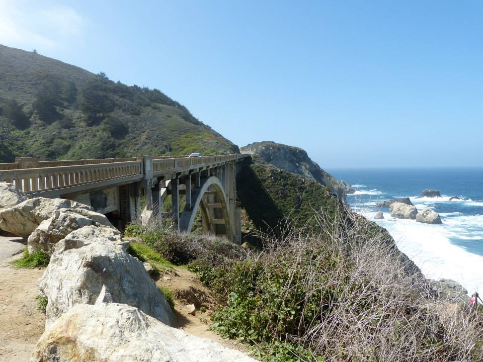
Following Highway 1, you will pass the Rocky Point, Where is the Rocky Point Restaurant, a restaurant that offers beautiful views of the coast. Nearby is the Notleys Landing viewpoint, an ocean observation point that can be a good stopover option before reaching Rocky Creek Bridge. Built in 1932, this concrete bridge is a “sister” to the famous Bixby Bridge and is located about 12 miles south of Carmel. It is just over 150 meters long and about 73 meters high at its highest point. Its name is a tribute to Rocky Creek, whose mouth is a habitat for sea otters. There is a detour with limited parking spaces northwest of the bridge, for tourist use.

3. BIXBY CREEK BRIDGE & CASTLE ROCK VIEWPOINT
About a mile south of Rocky Creek Bridge is Bixby Creek Bridge (also known as Bixby Canyon Bridge), the most famous reinforced concrete bridge in Big Sur, and the region's landmark. It was built in 1932, is 218 meters long, 7 meters wide and is 85 meters high. The best spot to take amazing pictures of her is the Castle Rock Viewpoint. Drive slowly so you don't miss this stop before reaching the bridge. There are few places to park your car, so patience will be your greatest ally during high season. The bridge is so famous that it has been a postage stamp, has appeared in television series and has been mentioned in some songs.


4. HURRICANE POINT VIEW
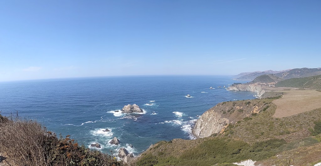
Passing the Bixby Creek Bridge, another point to see the bridge, a little further away, is the Hurricane Point View. It is one of the coolest spots on Highway 1, offering a panoramic view of the Pacific Ocean. Located about 170 meters above sea level, on a day of blue sky and sun, you will be thrilled with the beauty of the place. We have done this route several times and even our dog Luna has already visited this beautiful stop.

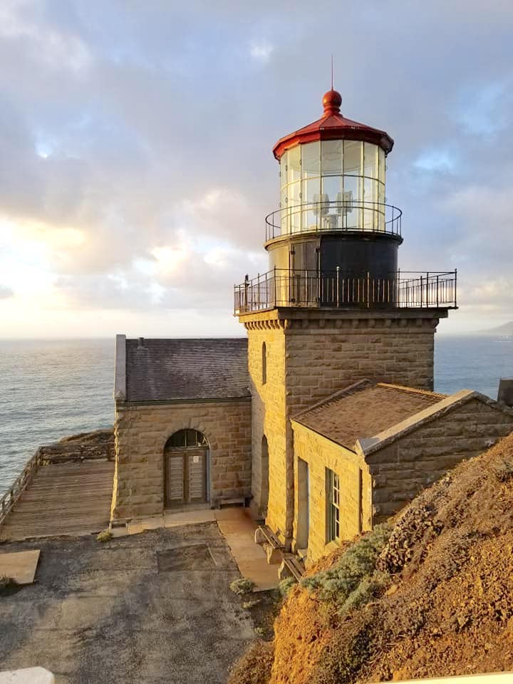
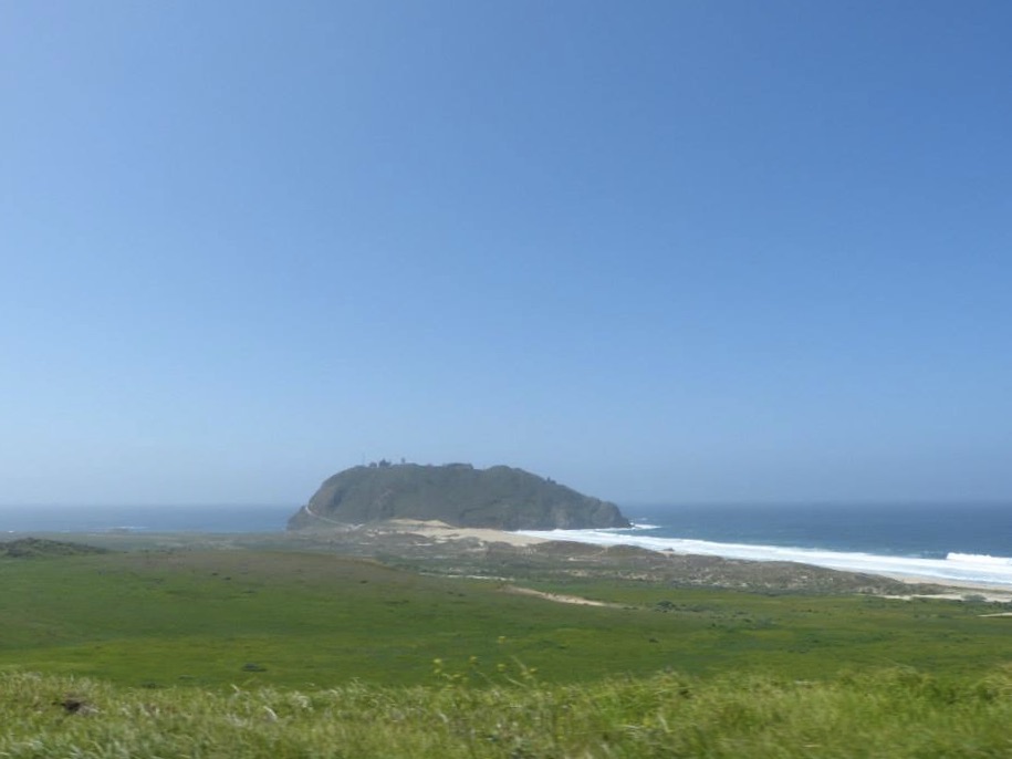
5. POINT SUR STATE HISTORIC PARK & POINT SUR LIGHTHOUSE
In the past Point Sur was a dangerous place that caused many shipwrecks. Because of this, it was decided to build a lighthouse there in 1889. It was only in 1986 that the site was established as a state park. Currently, the park contains the California's only complete turn of the 20th century lighthouse open to the public. Furthermore, Point Sur State Marine Reserve and Marine Conservation Area are marine protected areas that lie along the coast of the Point Sur Lighthouse. Like underwater parks, these marine protected areas help conserve ocean wildlife and marine ecosystems. See the official Point Sur State Historic Park pamphlet for more information. in this link.
- Address: CA-1, Monterey, CA 93940
- Schedules: vary – check the official website before you go
- Entrance: US$ 10 per vehicle (gives access to other Big Sur State Parks on the same day)
- Tours: 3-hour Lightstation walking tours are held throughout the year on Saturdays, Sundays and Wednesdays, and also on Thursdays during the months of July and August. It is not possible to book in advance and the tours are on a first-come, first-served basis. Visitors are advised to arrive half an hour before the tour, as the number of spaces is limited. see more information here | Prices: US$ 15 adults | US$ 5 children between 5 and 17 years old
- puppies: They are prohibited in the park.
6. ANDREW MOLERA STATE PARK
Established as a state park in 1968, this is the largest park by extension in the Big Sur area, although it is a relatively simple park, preserving land as requested by former owner Frances Molera. Situated at the mouth of the Big Sur River, the property was part of the Rancho El Sur land grant, and later owned by pioneer John Bautista Rogers Cooper and his descendants. Cooper's grandchildren, Andrew and Frances Molera, inherited the property from their mother in 1918. Andrew popularized the artichoke in California in 1922 and died in 1931. In 1965, Frances sold the property to The Nature Conservancy, stipulating that the park to be servant should be named after his brother. THE Molera Ranch House, the former ranch foreman's home, is open to the public as a museum that includes exhibits and artifacts about Big Sur pioneers, authors, artists, and the region's rich flora and fauna. See more details in this official pamphlet.
- Address: 45500 CA-1, Big Sur, CA 93920
- Schedules: daily from 8 am until sunset
- Entrance: US$ 10 per vehicle (gives access to other Big Sur State Parks on the same day)
- puppies: They are only allowed near the common use area of the parking lot.


7. BIG SUR VILLAGE
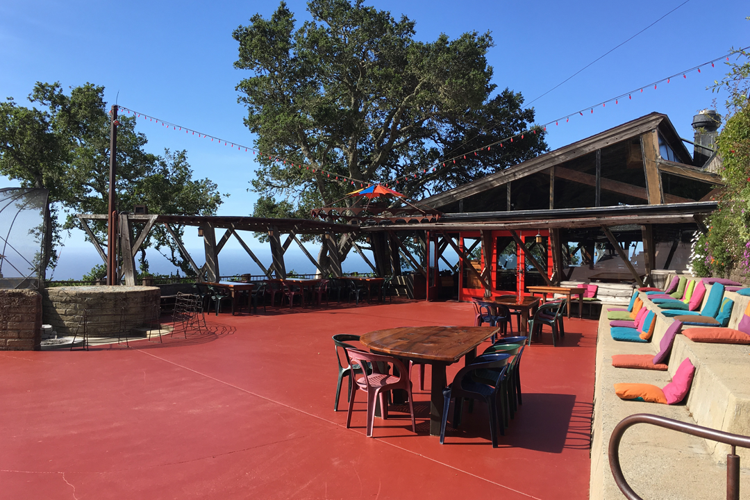
Because of the name, many people end up confusing the Big Sur region (which runs from southern Monterey to San Simeon and is about 115 km long) with the bigsur village, which is just over 1.5 km long. Although it has only about 1,500 inhabitants, the village of Big Sur is the most “urbanized” area in the region, housing most of the shops, restaurants, hotels, gas stations and other services on this stretch of Highway 1 (see location on the interactive map at the beginning of the post). even one library and the art gallery Hawthorne Gallery are located in the area. One of the best known restaurants, because of the view, not necessarily the food, is the Nepenthe.
8. PFEIFFER BIG SUR STATE PARK
In the Big Sur Village region is the Pfeiffer Big Sur State Park, a park of about 4 km² in extension, which is located on the banks of the Big Sur River. It is also known as “mini Yosemite”, a reference to the wonderful Yosemite Park, one of the most scenic national parks in the United States. Pfeiffer Big Sur State Park owes its name to John Pfeiffer, who lived in a cabin on the property from 1884. He was the son of Michael Pfeiffer and Barbara Laquet who immigrated from France and were among the first European settlers in the area. Many features in Big Sur are named after the descendants of the Pfeiffers. The park is known for its redwood groves and trail to Pfeiffer Falls. He owns a hotel (the Big Sur Lodge), a campground and a convenience store within its boundaries. See the official park flyer in this link for more information.
- Address: 47225 CA-1, Big Sur, CA 93920, United States
- Schedules: from 8 am to sunset
- Entrance: US$ 10 per vehicle (gives access to other Big Sur State Parks on the same day)
- puppies: They are allowed in the Warden's Path, the River Path, in addition to the common areas and camping.

9. PFEIFFER BEACH
This beach is hard to find because it's not exactly on Highway 1. It's about 3km from Pfeiffer Big Sur State Park on a road that is mostly unpaved. On-site parking is small and paid. As it is further away and has few parking areas, it is not usually very crowded. One of Pfeiffer Beach's main attractions is Keyhole Arch, a large rock that has a hole in the middle. A curiosity of this beach is that the sand usually turns purple after the rains, as fragments of rocks are carried by the rain to the sand.
- Address: 9100 Sycamore Canyon Rd, Big Sur, CA 93920, United States
- Schedules: from 9 am to sunset
- Entrance: US$ 12 to park
- puppies: are allowed in the guide


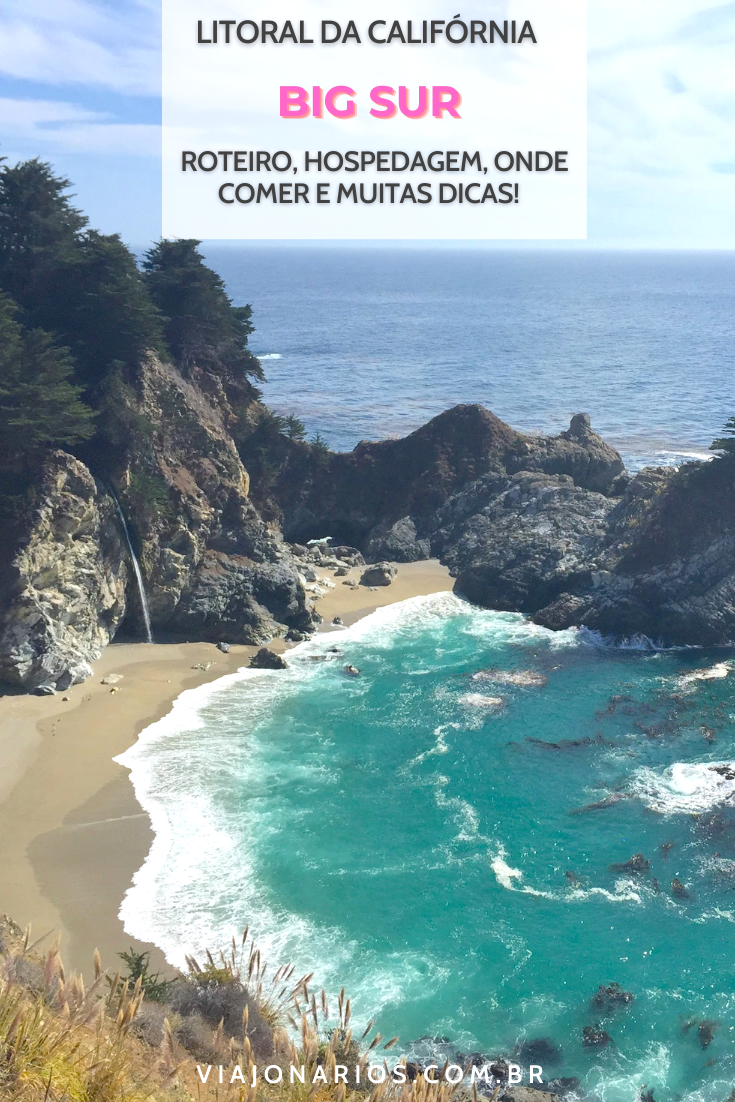
10. JULIA PFEIFFER BURNS STATE PARK & McWAY FALLS
Covering over 1,500 hectares, this is a state park located less than 20 km from Pfeiffer Big Sur State Park. It is famous for being home to the beautiful McWay Falls, the symbol waterfall of Big Sur that is 24 meters high and flows into the Pacific Ocean. In addition to the waterfall, the park is home to coastal redwoods up to 90 meters tall that are over 2,500 years old! The park's name is a tribute to Julia Pfeiffer Burns (more on her in dedicated post to McWay Falls). Big Creek State Marine Reserve and Big Creek State Marine Conservation Area are marine protected areas off the coast of Julia Pfeiffer Burns State Park. Like underwater parks, these marine protected areas help conserve ocean wildlife and marine ecosystems. See more details about the park at official pamphlet.
- Address: 52801 CA-1, Big Sur, CA 93920
- Schedules: from 8 am to sunset
- Entrance: US$ 10 per vehicle (gives access to other Big Sur State Parks on the same day)
- puppies: They are not allowed beyond the parking area.
Read more: California Coast: McWay Falls, the Big Sur waterfall

11. JOHN LITTLE STATE NATURAL RESERVE
Established in 1953, the John Little State Natural Reserve is a relatively unknown state property that aims to preserve and protect an area of steep cliffs off the coast of Big Sur, where Lime Creek empties into the Pacific Ocean. The reserve is home to the original cabin, built in 1917, by former conservationist Elizabeth K. Livermore. As it is a conservation area, access to the rocky beach is not allowed. The reserve is often closed to the public, but when it is open, it is worth stopping for a great view of the unspoilt coastline of this region. Close to the reserve is the Esalen Institute, an alternative spiritual retreat and luxury spa.
- Address: 55420 Cabrillo Hwy, Big Sur, CA 93920, United States
- Schedules: often closed to the public | check the official event website
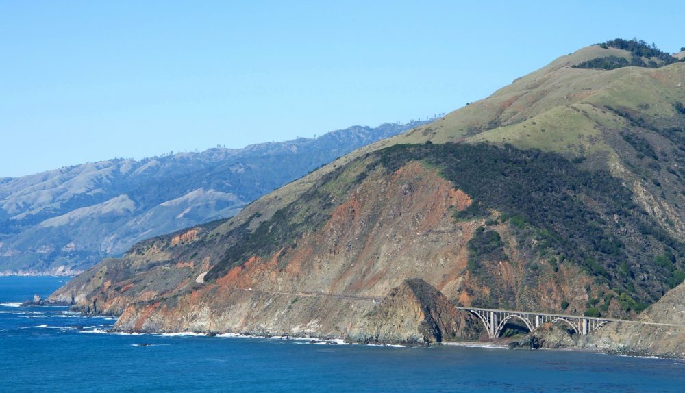
12. BIG CREEK BRIDGE & BIG CREEK COVE VIEW POINT
The Big Creek Bridge is a 180 meter long reinforced concrete arch bridge. Built in 1938, the bridge is over Big Creek Canyon. Not to be confused with Bixby Creek Bridge, which we have already commented on in item #3 of this post and is the most famous bridge in Big Sur. Here, the request is also to make a stop to enjoy the beach of Big Creek Cove, which is under the bridge. Landels-Hill Big Creek Reserve is the area adjacent to the creek and marine protected areas of California called the Big Creek State Marine Reserve and the Big Creek State Conservation Area. Entrance to the site is closed to the general public, but the area is managed by the University of California Santa Cruz and organizes events for educational and research purposes. There are parking areas at both ends of the bridge over Big Creek for parking and taking pictures.
13. GAMBOA POINT
Gamboa Point Beach is a beach that is not accessible to the public because it is privately owned. The best way to see it is to drive to Gamboa Point, which offers a great view of the beach and a great place to take pictures. It is a “consolation prize” for not being able to get close to this beach.
14. LIMEKILN STATE PARK
The name of the park is due to the fact that in it are some “lime kilm”, which are cauldrons made of limestone used to produce calcium oxide (better known as lime). Lime was a key ingredient in cement that was used for construction in San Francisco and Monterey and was produced at this location between 1887 and 1890 by the Rockland Lime and Lumber Company. However, after three years, the company had exhausted most of the local limestone, as well as the sequoia used to burn the kilns. Today, an easy half-mile trail leads to the ruins of the lime smelter, which includes four kilns and some stone walls. In addition, the park has a beach, a coastal redwood forest and a 30-meter high waterfall known as Limekiln Falls. Check out the park's official flyer in this link.
- Address: 63025 CA-1, Big Sur, CA 93920, United States
- Schedules: daily from 8 am to sunset
- Entrance: US$ 10 per vehicle (gives access to other Big Sur State Parks on the same day)
- puppies: They are not allowed beyond the parking lot.
15. SAND DOLLAR BEACH & JADE COVE
This beach, known as the Sand Dollar Picnic Area, is a delightful spot with several options for activities, such as picnicking, camping, walking on the sand and even surfing. It has a good infrastructure with a camping area, bathrooms, barbecue and picnic tables. This is one of the few spots in Big Sur that are good for surfing. The beach consists of a beautiful strip of sand where jade stones and other rounded marine stones can be found. nearby, on jade cove It is possible to find more of these beautiful green stones, but the biggest and most valuable ones were taken a long time ago. Wear sturdy shoes to explore this cove as the descent is steep and the coast is very rocky. To get to Sand Dollar Beach, park your car and follow a sandy path that leads up to a long wooden staircase.
- Address: 69232 Cabrillo Hwy, Big Sur, CA 93920, United States
- Schedules: daily from 10 am to 6 pm
- Entrance: US$ 10 per vehicle (gives access to other Big Sur State Parks on the same day)
- puppies: allowed in tab

16. RAGGED POINT
Ragged Point is a headland that features seaside cliffs, beaches, and walking trails. In this beautiful area that offers beautiful views of the ocean, there is also a resort, the Ragged Point Inn & Resort, a restaurant and a gas station. There is a small black sand beach north of the rocky outcrop called Ragged Point Beach, which is separated by a rock from San Carpoforo Creek Beach and the San Carpoforo Creek Trail. The area around Ragged Point is home to various forms of wildlife, including elephant seals, sea otters and birds. The trail to Ragged Point Beach (also known as Young Creek Beach) at the base of the cliffs is only 800 meters but is steep with about 120 meters change in elevation. The views of the beach below are incredible!
- Address: 19019 Highway 1, San Simeon, CA 93452
- Schedules: from sunrise to sunset
- Entrance: free
- puppies: allowed
17. PIEDRAS BLANCAS LIGHT STATION
The Piedras Blancas Lighthouse is a historic landmark on California's central coast. It is located in a rugged area and started operating in 1875. The name is a reference to the white rocks that exist near the coast. These rocks and rugged coastline are home to seabirds, sea lions and elephant seals. More than 70 native plant species can be found on the 19 acres surrounding Light Station. Over the years, earthquakes have caused damage to the lighthouse. An earthquake on the last day of 1948 resulted in the upper part of the lighthouse being declared structurally damaged. In 1949, the three upper levels (fourth landing, lookout room and lantern) were removed. Currently, access to the lighthouse is exclusively through guided tours lasting 2 hours, which seek to present cultural and natural history, as well as having the opportunity to see beautiful landscapes.
- Address: 15950 Cabrillo Hwy, San Simeon, CA 93452, United States
- Schedules: from mid June to August from Monday to Saturday | from September to mid-June on Tuesdays, Thursdays and Saturdays
- Entrance: US$ 10 – Tickets must be purchased in advance at official site and, on the day, wait at the former Piedras Blancas Motel (16420 Cabrillo Hwy, San Simeon, CA 93452) which is 2.5 km north of the lighthouse
- puppies: not allowed


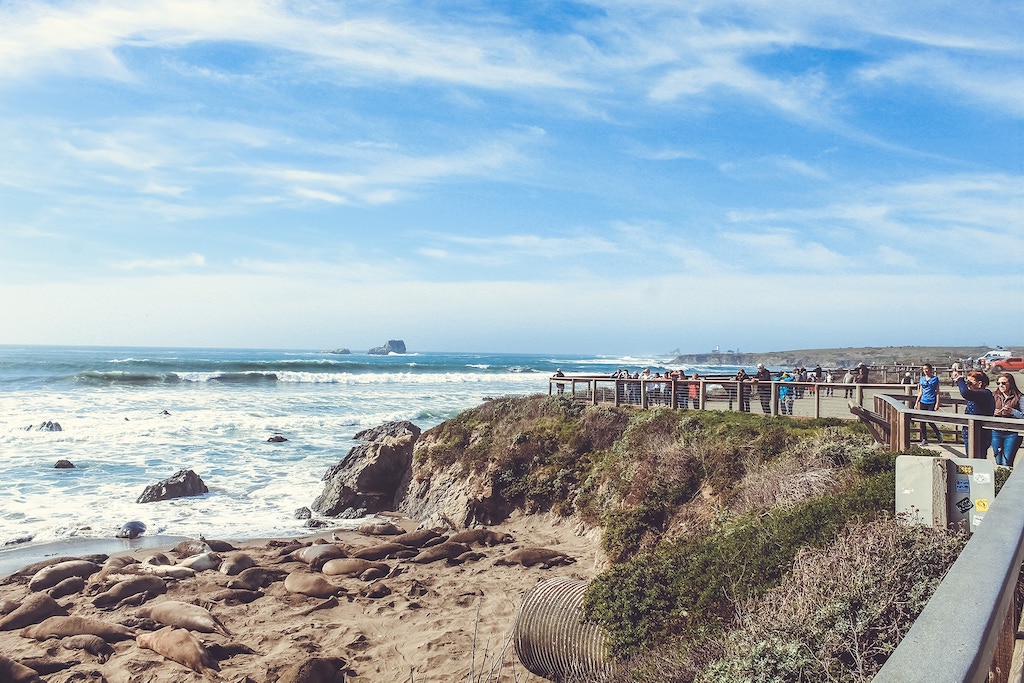
18. ELEPHANT SEAL VISTA POINT & FRIENDS OF THE ELEPHANT SEAL VISITOR CENTER AND GIFT SHOP
Located about five miles north of Hearst Castle, the Elephant Seal Vista Point (also known as Piedras Blancas Elephant Seal Rookery) consists of a viewpoint where you can observe the place where a huge number of elephant seals are concentrated. The months of April and May bring the greatest number of seals to the beaches of the elephant seal colony of Piedras Blancas, with thousands of seals arriving for the spring season. At the same time, seals weaned for the winter are leaving for their first migration to the Pacific. They won't be back until the fall trip between September and November. You can see them live through from this link. They are cute, but we were once in high season and we have to confess that the unpleasant smell of the pets made us run out of there. Be warned, huh! Also take the opportunity to discover the Friends Of The Elephant Seal Visitor Center and Gift Shop, which is home to a visitor center and gift shop, a little further down the road
- Addresses: Lookout: GPS coordinates: 35.663028, -121.257556
- Visitor Center: Plaza del Cavalier, 250 San Simeon Ave Suite 3B, San Simeon, CA 93452
- Schedules: confirm on the official website
- Entrance: free

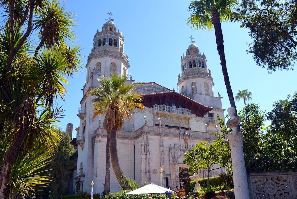
19. HEARST CASTLE
Hearst Castle is a huge mansion located high on a hill in the city of San Simeon and was built between 1919 and 1947 by the communication magnate William Randolph Hearst. The area where the castle is located is currently known as Hearst San Simeon State Historical Monument. The place was very frequented by politicians and Hollywood celebrities of the time. The building has 56 rooms, 61 bathrooms and 19 rooms. In addition, it has a gigantic pool inspired by Greco-Roman art, an indoor pool, tennis courts, gardens and a cinema room. The film “Citizen Kane” (1941) by Orson Welles was inspired by the castle to create “Xanadu” and the film mogul is very reminiscent of William Randolph Hearst. Another interesting fact of the time is that the property had a number of exotic animals, as William Randolph was fascinated by them. The site can only be visited through guided tours.
- Address: 750 Hearst Castle Rd, San Simeon, CA 93452, United States
- Schedules: tours available daily between 9 am and 4 pm
- Entrance: from US$ 25 adults / US$ 12 children between 5 and 12 years old
Read more: Hearst Castle: Castle on the California Coast
20. HEARST SAN SIMEON STATE PARK
Hearst San Simeon State Park is one of the oldest state parks in California. The scenic park's cliffs and coastal headlands offer panoramic views of the ocean and rocky coastline. The park includes:
- Santa Rosa Creek Natural Preserve: an area that includes valuable riparian forests and coastal marshes, which provide habitat for an endangered fish
- San Simeon Natural Preserve: consists of vast swamps, riparian areas, and various native plant communities, as well as being the wintering ground for monarch butterfly populations.
- Pa-nu Cultural Preserve: contains the park's most significant archaeological site, which has been dated to 5,850 years ago and contains significant evidence documenting prehistoric technology, subsistence practices and social organization over several centuries.
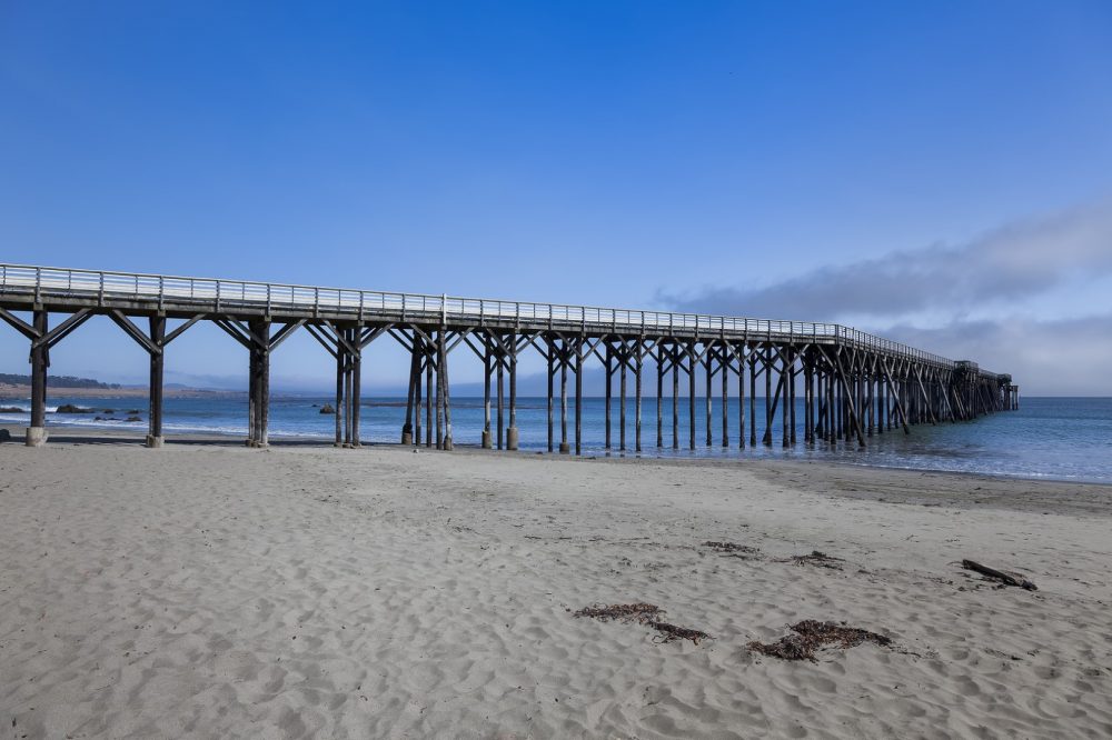
The exhibition areas are open to the public throughout the year. No reservations are required and there is no fee. However, the site does not provide toilets, the closest ones being 6.5 km south of the observation areas in William Randolph Hearst Memorial Beach, a very nice beach with calm waters that has a pier and is used for kayaking and rowing. The beach is divided into two sections: one that is state-owned and the other that is privately owned, still owned by the Hearst family. Although it is privately owned, the Hearst family still allows anyone to enjoy the beach. See more information about Hearst San Simeon State Park and Historical Monument in this official pamphlet.
- Address: 500 San Simeon-Monterey Creek Rd, Cambria, CA 93428, United States
- Schedules: not informed
- Entrance: free
- puppies: Allowed on tab only William Randolph Hearst Memorial Beach, south of Lone Palm Dr. and on boardwalks and campgrounds.
TOURS AND EXCURSIONS IN BIG SUR & SURROUNDINGS
Below, check out some options for tours, tours and excursions that include the Big Sur region and its surroundings.
WHERE TO EAT IN BIG SUR
For when hunger (or thirst) hits, below are some restaurant suggestions, Big Sur. Check out some options below, separated by region:
ROCKY POINT
BIG SUR

LUCIA
FAT
RAGGED POINT
SAN SIMEON
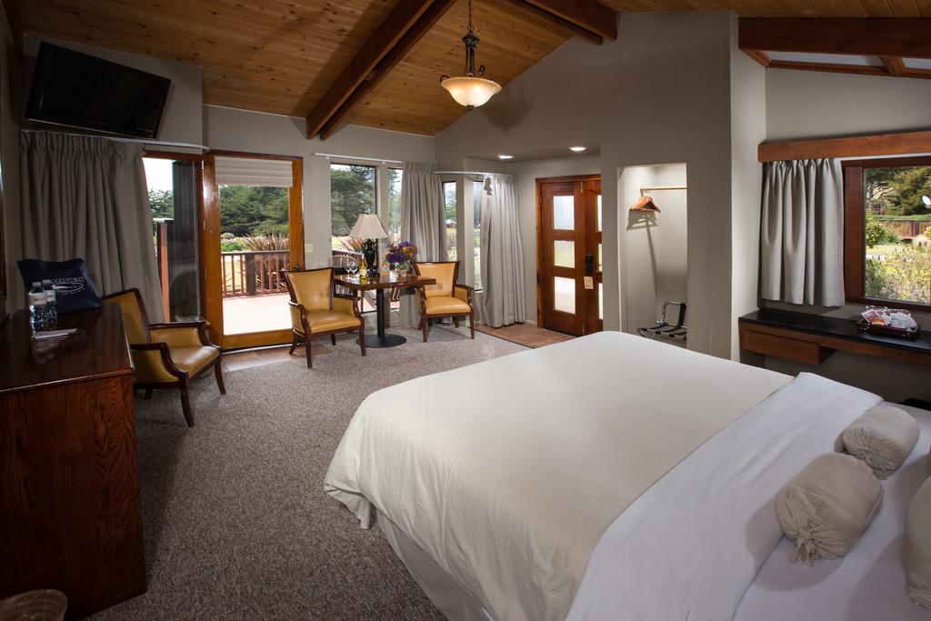
WHERE TO STAY IN BIG SUR
For those planning to stay in Big Sur, the region offers a wide range of accommodation to suit all budgets. We have selected some well-rated options by guests to help you choose your accommodation options in the city. The number of stars is in front of the name of each hotel.
BIG SUR
- Big Sur River Inn
- Glen Oaks Big Sur
- Fernwood Resort
- Big Sur Lodge
- Deetjen's Big Sur Inn
- Post Ranch Inn
- Ventana Big Sur
LUCIA
- Lucia Lodge (setting from Netflix's "Ratched" series)
FAT
RAGGED POINT
SAN SIMEON
BOOK NOW your hotel and save up to 50%. Travelers readers are with a SUPER DISCOUNT! And the best, with FREE CANCELLATION*!
Booking.com
*check the hotels with free cancellation on the website
Save these tips to Pinterest!
Read more about California:
- The amazing Yosemite Park in California
- California: Death Valley, the Valley of Death
- California: Sequoia National Park, the park of the giant sequoias
- Crystal Cave: Marble Cave at Sequoia Park in California
- California: Kings Canyon Park and the Deepest Canyon in the USA
- Big Basin Redwoods Park: California's Oldest Park
- What to do in Los Angeles – 4 to 6 days itinerary
- California: What to do in San Francisco – 5-Day Itinerary
- California: What to do in San Diego – 3 or 4 days itinerary


